 vesseltracker.com
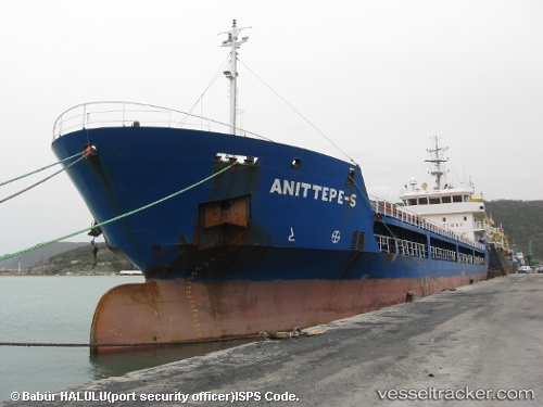
 ANITTEPE S
Current Status
Where is the vessel?
ANITTEPE S is currently in 16 nm SW of Finike, based on AIS data received about 2h ago.
Latest AIS update:
Current position: 36.05833° N, 29.95500° E (16 nm SW of Finike)
Average speed (last 7 days): Loading…
Average speed (last 30 days): Loading…
Vessel profile: ANITTEPE S is a General Cargo with dimensions m x m.
This page combines live AIS, route history, probable destination signals, nearby traffic, and port activity for practical vessel monitoring.
The current position of vessel ANITTEPE S is 36.05833 lat / 29.95500 lng. Updated: 2026-03-27 00:55:20 UTCNearest reference points:
- Near Finike
- Near KAS
- Near Kemer
Currently sailing under the flag of Liberia ![]()
Details:
Live Vessel ANITTEPE S Analytics (details, animations, etc.)
Recent AIS points (UTC):
2026-03-26 18:47:32 UTC · 36.21018, 29.07329 · SOG 7.1 kn · COG 107°2026-03-26 21:36:22 UTC · 36.09621, 29.45667 · SOG 7.1 kn · COG 110°
2026-03-26 23:26:32 UTC · 36.06200, 29.71819 · SOG 7.7 kn · COG 91°
2026-03-27 00:55:20 UTC · 36.05833, 29.95500 · SOG 7 kn · COG -1°