 vesseltracker.com
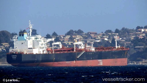
 Zaruma
Current Status
Where is the vessel?
Zaruma is currently in 13 nm SE of Lucaya, based on AIS data received about 1h ago.
Latest AIS update:
Current position: 26.40837° N, 78.41644° W (13 nm SE of Lucaya)
Average speed (last 7 days): Loading…
Average speed (last 30 days): Loading…
Vessel profile: Zaruma is a Crude Oil Tanker with dimensions 244m x 41m.
This page combines live AIS, route history, probable destination signals, nearby traffic, and port activity for practical vessel monitoring.
The current position of vessel Zaruma is 26.40837 lat / -78.41644 lng. Updated: 2026-03-29 19:34:14 UTCNearest reference points:
- 44 nm S of Freeport
- 44 nm E of Surfside
- Near Green Turtle Cay
Currently sailing under the flag of Panama ![]()
Zaruma built in 2009 year
Deadweight:
105073 tDetails:
Live Vessel Zaruma Analytics (details, animations, etc.)
Recent AIS points (UTC):
2026-03-29 13:33:17 UTC · 26.56167, -78.23833 · SOG 1 kn · COG -1°2026-03-29 15:33:18 UTC · 26.52667, -78.28500 · SOG 1 kn · COG -1°
2026-03-29 17:46:34 UTC · 26.47356, -78.35033 · SOG 2.7 kn · COG 146°
2026-03-29 19:34:14 UTC · 26.40837, -78.41644 · SOG 3.1 kn · COG 156°