 vesseltracker.com
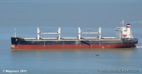
 PORT MACAU
Current Status
Where is the vessel?
PORT MACAU is currently in Near WEDA, based on AIS data received about 2h ago.
Latest AIS update:
Current position: 0.47167° N, 127.96333° E (Near WEDA)
Average speed (last 7 days): Loading…
Average speed (last 30 days): Loading…
Vessel profile: PORT MACAU is a Bulk Carrier with dimensions 190m x 32m.
This page combines live AIS, route history, probable destination signals, nearby traffic, and port activity for practical vessel monitoring.
The current position of vessel PORT MACAU is 0.47167 lat / 127.96333 lng. Updated: 2026-04-04 06:55:52 UTCNearest reference points:
- 13 nm NE of WEDA
- Near TERNATE
- 55 nm S of Labuha, Molucas
Currently sailing under the flag of Marshall Islands ![]()
PORT MACAU built in 2008 year
Deadweight:
58730 tDetails:
Live Vessel PORT MACAU Analytics (details, animations, etc.)
Recent AIS points (UTC):
2026-04-04 01:40:51 UTC · 0.47167, 127.96333 · SOG 0 kn · COG -1°2026-04-04 03:52:52 UTC · 0.47167, 127.96333 · SOG 0 kn · COG -1°
2026-04-04 05:04:54 UTC · 0.47167, 127.96333 · SOG 0 kn · COG -1°
2026-04-04 06:55:52 UTC · 0.47167, 127.96333 · SOG 0 kn · COG -1°