 vesseltracker.com
 Parkgracht
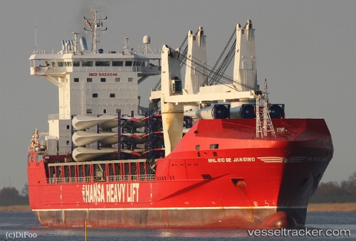
Current Status
Where is the vessel?
Parkgracht is currently in 24 nm NE of Moa, based on AIS data received less than 1h ago.
Latest AIS update:
Current position: 20.86167° N, 74.53167° W (24 nm NE of Moa)
Average speed (last 7 days): Loading…
Average speed (last 30 days): Loading…
Vessel profile: Parkgracht is a Heavy Load Carrier with dimensions 168m x 25m.
This page combines live AIS, route history, probable destination signals, nearby traffic, and port activity for practical vessel monitoring.
The current position of vessel Parkgracht is 20.86167 lat / -74.53167 lng. Updated: 2026-04-01 10:03:35 UTCNearest reference points:
- 47 nm SW of Cockburn Harbour
- 56 nm SW of Cockburn Harbour
Currently sailing under the flag of Netherlands ![]()
Parkgracht built in 2009 year
Deadweight:
20170 tDetails:
Live Vessel Parkgracht Analytics (details, animations, etc.)
Recent AIS points (UTC):
2026-04-01 03:15:34 UTC · 21.28500, -75.88833 · SOG 11 kn · COG -1°2026-04-01 06:06:35 UTC · 21.05667, -75.32333 · SOG 12 kn · COG -1°
2026-04-01 07:21:35 UTC · 20.99833, -75.07000 · SOG 11 kn · COG -1°
2026-04-01 10:03:35 UTC · 20.86167, -74.53167 · SOG 11 kn · COG -1°