 vesseltracker.com
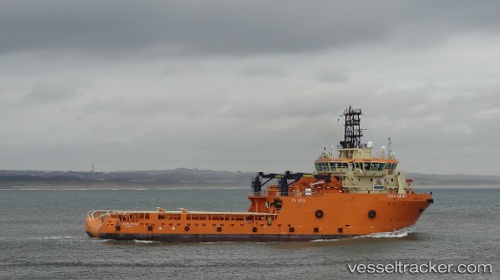
 UMKHUSELI
Current Status
Where is the vessel?
UMKHUSELI is currently in 13 nm SE of Moorreesburg, based on AIS data received about 1h ago.
Latest AIS update:
Current position: 34.60942° S, 18.89754° E (13 nm SE of Moorreesburg)
Average speed (last 7 days): Loading…
Average speed (last 30 days): Loading…
Vessel profile: UMKHUSELI is a Offshore Tug/Supply Ship with dimensions 83m x 22m.
This page combines live AIS, route history, probable destination signals, nearby traffic, and port activity for practical vessel monitoring.
The current position of vessel UMKHUSELI is -34.60942 lat / 18.89754 lng. Updated: 2026-03-30 10:00:51 UTCNearest reference points:
- 15 nm SE of Moorreesburg
- Near Mitchells Plain
- 18 nm SW of Cape Of Good Hope
Currently sailing under the flag of South Africa ![]()
UMKHUSELI built in 2013 year
Deadweight:
4427 tDetails:
Live Vessel UMKHUSELI Analytics (details, animations, etc.)
Recent AIS points (UTC):
2026-03-30 03:39:10 UTC · -34.91597, 20.17783 · SOG 10.9 kn · COG 270°2026-03-30 05:22:33 UTC · -34.87744, 19.79987 · SOG 10.5 kn · COG 275°
2026-03-30 08:01:52 UTC · -34.76041, 19.27409 · SOG 10.1 kn · COG 296°
2026-03-30 10:00:51 UTC · -34.60942, 18.89754 · SOG 11 kn · COG 293°