 vesseltracker.com
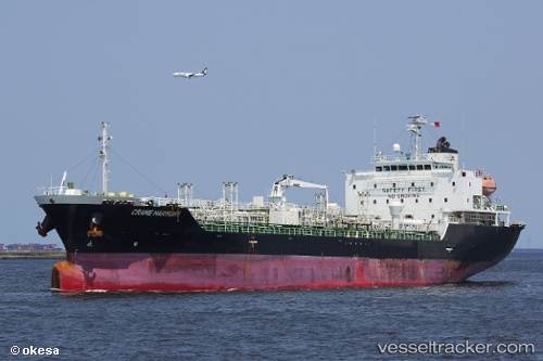
Grace Harmony
Current StatusWhere is the vessel?
Grace Harmony is currently in 75 nm W of Labuanbajo, based on AIS data received less than 1h ago.
Latest AIS update:
Current position: 0.06333° S, 118.79167° E (75 nm W of Labuanbajo)
Average speed (last 7 days): Loading…
Average speed (last 30 days): Loading…
Vessel profile: Grace Harmony is a Chemical Oil Products Tanker with dimensions 20m x 119m.
This page combines live AIS, route history, probable destination signals, nearby traffic, and port activity for practical vessel monitoring.
The current position of vessel Grace Harmony is -0.06333 lat / 118.79167 lng. Updated: 2026-03-31 15:42:39 UTCNearest reference points:
- 56 nm SE of Santan Terminal
- 39 nm W of Labuanbajo
- 29 nm W of Labuanbajo
Details:
Live Vessel Grace Harmony Analytics (details, animations, etc.)
Recent AIS points (UTC):
2026-03-31 10:15:36 UTC · 0.59167, 119.60667 · SOG 10 kn · COG -1°2026-03-31 12:21:41 UTC · 0.34500, 119.29667 · SOG 12 kn · COG -1°
2026-03-31 14:03:40 UTC · 0.13333, 119.03500 · SOG 11 kn · COG -1°
2026-03-31 15:42:39 UTC · -0.06333, 118.79167 · SOG 11 kn · COG -1°