 vesseltracker.com
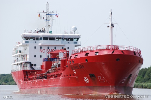
Prima
Current StatusWhere is the vessel?
Prima is currently in 54 nm NE of NACALA PORTO, based on AIS data received about 2h ago.
Latest AIS update:
Current position: 13.89383° S, 41.30009° E (54 nm NE of NACALA PORTO)
Average speed (last 7 days): Loading…
Average speed (last 30 days): Loading…
Vessel profile: Prima is a Chemical Oil Products Tanker with dimensions 17m x 113m.
This page combines live AIS, route history, probable destination signals, nearby traffic, and port activity for practical vessel monitoring.
The current position of vessel Prima is -13.89383 lat / 41.30009 lng. Updated: 2026-04-09 01:32:04 UTCNearest reference points:
- 10 nm N of NACALA PORTO
- Near NACALA PORTO
- 47 nm NW of Mohéli Apt
Details:
Live Vessel Prima Analytics (details, animations, etc.)
Recent AIS points (UTC):
2026-04-08 15:59:57 UTC · -14.02615, 40.94896 · SOG 1.6 kn · COG 36°2026-04-08 15:59:57 UTC · -14.02615, 40.94896 · SOG 1.6 kn · COG 36°
2026-04-09 00:19:50 UTC · -13.93341, 41.24158 · SOG 3.3 kn · COG 45°
2026-04-09 01:32:04 UTC · -13.89383, 41.30009 · SOG 3.4 kn · COG 45°