 vesseltracker.com
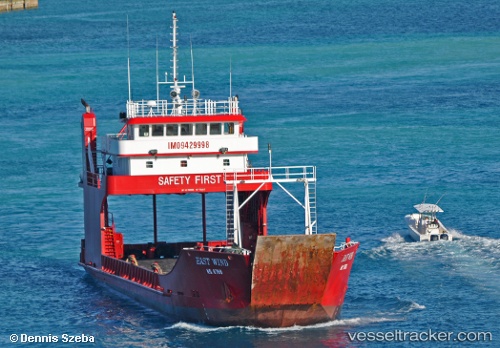
East Wind
Current StatusWhere is the vessel?
East Wind is currently in Near Nassau, based on AIS data received about 3h ago.
Latest AIS update:
Current position: 25.07762° N, 77.32573° W (Near Nassau)
Average speed (last 7 days): Loading…
Average speed (last 30 days): Loading…
Vessel profile: East Wind is a Ro Ro Cargo Ship with dimensions 11m x 54m.
This page combines live AIS, route history, probable destination signals, nearby traffic, and port activity for practical vessel monitoring.
The current position of vessel East Wind is 25.07762 lat / -77.32573 lng. Updated: 2026-03-28 13:41:53 UTCNearest reference points:
- Near Nassau
- Near Lyford Cay
- 11 nm S of Lyford Cay
Details:
Live Vessel East Wind Analytics (details, animations, etc.)
Recent AIS points (UTC):
2026-03-28 08:11:53 UTC · 24.83940, -77.11742 · SOG 9.3 kn · COG -1°2026-03-28 10:04:44 UTC · 25.06908, -77.27203 · SOG 9.1 kn · COG -1°
2026-03-28 11:22:33 UTC · 25.07819, -77.32555 · SOG 0 kn · COG -1°
2026-03-28 13:41:53 UTC · 25.07762, -77.32573 · SOG 0 kn · COG -1°