 vesseltracker.com
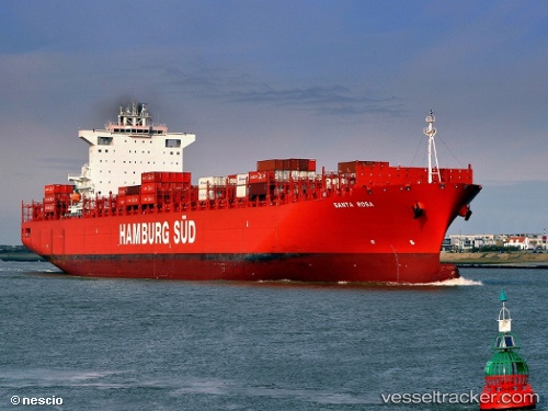
 Santa Rosa
Current Status
Where is the vessel?
Santa Rosa is currently in 386 nm E of Levelwood, based on AIS data received less than 1h ago.
Latest AIS update:
Current position: 12.88686° S, 0.52630° E (386 nm E of Levelwood)
Average speed (last 7 days): Loading…
Average speed (last 30 days): Loading…
Vessel profile: Santa Rosa is a Container Ship with dimensions 300m x 43m.
This page combines live AIS, route history, probable destination signals, nearby traffic, and port activity for practical vessel monitoring.
The current position of vessel Santa Rosa is -12.88686 lat / 0.52630 lng. Updated: 2026-03-30 05:20:39 UTCNearest reference points:
- Open sea, approx. 402 nm off the nearest listed port
- Open sea, approx. 403 nm off the nearest listed port
- Open sea, approx. 406 nm off the nearest listed port
Currently sailing under the flag of Denmark ![]()
Santa Rosa built in 2011 year
Deadweight:
93398 tDetails:
Live Vessel Santa Rosa Analytics (details, animations, etc.)
Recent AIS points (UTC):
2026-03-30 00:00:31 UTC · -11.45333, -0.54833 · SOG 19 kn · COG -1°2026-03-30 02:10:53 UTC · -12.04680, -0.12026 · SOG 19.7 kn · COG 140°
2026-03-30 03:40:44 UTC · -12.44277, 0.19244 · SOG 20 kn · COG 142°
2026-03-30 05:20:39 UTC · -12.88686, 0.52630 · SOG 19.8 kn · COG 143°