 vesseltracker.com
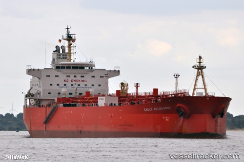
 UOG KYMA
Current Status
Where is the vessel?
UOG KYMA is currently in Near Dos Bocas Terminal, based on AIS data received about 2h ago.
Latest AIS update:
Current position: 18.48706° N, 93.23686° W (Near Dos Bocas Terminal)
Average speed (last 7 days): Loading…
Average speed (last 30 days): Loading…
Vessel profile: UOG KYMA is a Oil Products Tanker with dimensions m x m.
This page combines live AIS, route history, probable destination signals, nearby traffic, and port activity for practical vessel monitoring.
The current position of vessel UOG KYMA is 18.48706 lat / -93.23686 lng. Updated: 2026-03-28 18:04:36 UTCNearest reference points:
- 35 nm S of Yùum K'Ak'Náab
- Near Coatzacoalcos
- 18 nm S of Yùum K'Ak'Náab
Currently sailing under the flag of Cyprus ![]()
Details:
Live Vessel UOG KYMA Analytics (details, animations, etc.)
Recent AIS points (UTC):
2026-03-28 12:28:31 UTC · 18.48734, -93.23702 · SOG 0 kn · COG 66°2026-03-28 13:31:58 UTC · 18.48766, -93.23714 · SOG 0 kn · COG 77°
2026-03-28 15:34:32 UTC · 18.48762, -93.23710 · SOG 0 kn · COG 71°
2026-03-28 18:04:36 UTC · 18.48706, -93.23686 · SOG 0 kn · COG 55°