 vesseltracker.com
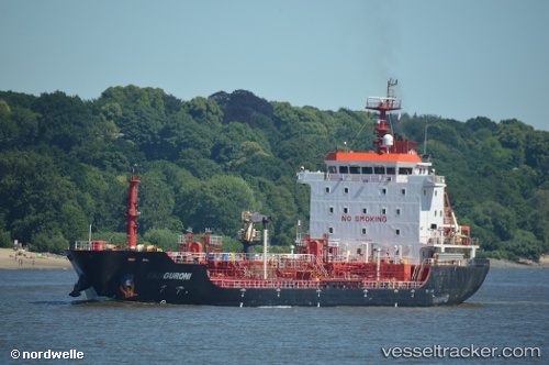
 GURONI
Current Status
Where is the vessel?
GURONI is currently in Near Evyap Port /Kocaeli, based on AIS data received less than 1h ago.
Latest AIS update:
Current position: 40.76915° N, 29.68870° E (Near Evyap Port /Kocaeli)
Average speed (last 7 days): Loading…
Average speed (last 30 days): Loading…
Vessel profile: GURONI is a Oil/Chemical Tanker with dimensions m x m.
This page combines live AIS, route history, probable destination signals, nearby traffic, and port activity for practical vessel monitoring.
The current position of vessel GURONI is 40.76915 lat / 29.68870 lng. Updated: 2026-04-17 05:57:20 UTCNearest reference points:
- Near YARIMCA
- Near KORFEZ
- Near Diliskelesi
Currently sailing under the flag of Turkey ![]()
Details:
Live Vessel GURONI Analytics (details, animations, etc.)
Recent AIS points (UTC):
2026-04-17 00:18:18 UTC · 40.76845, 29.68771 · SOG 0 kn · COG 356°2026-04-17 02:39:16 UTC · 40.76844, 29.68769 · SOG 0 kn · COG 355°
2026-04-17 03:45:14 UTC · 40.76841, 29.68801 · SOG 0 kn · COG 342°
2026-04-17 05:57:20 UTC · 40.76915, 29.68870 · SOG 0 kn · COG 301°