 vesseltracker.com
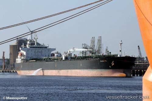
 ALIGOTE
Current Status
Where is the vessel?
ALIGOTE is currently in 64 nm E of Marsa Alam, based on AIS data received about 1h ago.
Latest AIS update:
Current position: 25.64146° N, 35.74515° E (64 nm E of Marsa Alam)
Average speed (last 7 days): Loading…
Average speed (last 30 days): Loading…
Vessel profile: ALIGOTE is a Chemical/Oil Tanker with dimensions 230m x 32m.
This page combines live AIS, route history, probable destination signals, nearby traffic, and port activity for practical vessel monitoring.
The current position of vessel ALIGOTE is 25.64146 lat / 35.74515 lng. Updated: 2026-04-03 11:56:42 UTCNearest reference points:
- 41 nm NW of Umm Lajj
- Near DUBA
- 35 nm S of Umm Lajj
Currently sailing under the flag of Marshall Islands ![]()
ALIGOTE built in 2010 year
Deadweight:
74192 tDetails:
Live Vessel ALIGOTE Analytics (details, animations, etc.)
Recent AIS points (UTC):
2026-04-03 06:11:41 UTC · 24.93833, 36.25333 · SOG 8 kn · COG -1°2026-04-03 08:02:40 UTC · 25.16500, 36.09333 · SOG 8 kn · COG -1°
2026-04-03 10:13:02 UTC · 25.43234, 35.90794 · SOG 8.8 kn · COG 318°
2026-04-03 11:56:42 UTC · 25.64146, 35.74515 · SOG 8.8 kn · COG 322°