 vesseltracker.com
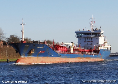
 MARMEA
Current Status
Where is the vessel?
MARMEA is currently in Near KHOMS, based on AIS data received about 3h ago.
Latest AIS update:
Current position: 32.70341° N, 14.46908° E (Near KHOMS)
Average speed (last 7 days): Loading…
Average speed (last 30 days): Loading…
Vessel profile: MARMEA is a Chemical/Oil Products Tanker with dimensions 122m x 16m.
This page combines live AIS, route history, probable destination signals, nearby traffic, and port activity for practical vessel monitoring.
The current position of vessel MARMEA is 32.70341 lat / 14.46908 lng. Updated: 2026-03-27 23:38:01 UTCNearest reference points:
- Near MISURATA
- 22 nm NW of Tarabulus
- 37 nm E of Didon
Currently sailing under the flag of Liberia ![]()
MARMEA built in 2008 year
Deadweight:
6221 tDetails:
Live Vessel MARMEA Analytics (details, animations, etc.)
Recent AIS points (UTC):
2026-03-27 17:54:03 UTC · 32.71835, 14.38935 · SOG 7.6 kn · COG 335°2026-03-27 20:05:42 UTC · 32.78141, 14.37387 · SOG 2.4 kn · COG 238°
2026-03-27 21:31:52 UTC · 32.74928, 14.42232 · SOG 2.2 kn · COG 236°
2026-03-27 23:38:01 UTC · 32.70341, 14.46908 · SOG 1.5 kn · COG 244°