 vesseltracker.com
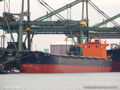
 SANTA CRUZ
Current Status
Where is the vessel?
SANTA CRUZ is currently in 26 nm E of Boboras, based on AIS data received about 17h ago.
Latest AIS update:
Current position: 46.28008° N, 7.54764° W (26 nm E of Boboras)
Average speed (last 7 days): Loading…
Average speed (last 30 days): Loading…
Vessel profile: SANTA CRUZ is a Bulk Carrier with dimensions m x m.
This page combines live AIS, route history, probable destination signals, nearby traffic, and port activity for practical vessel monitoring.
The current position of vessel SANTA CRUZ is 46.28008 lat / -7.54764 lng. Updated: 2026-04-10 08:05:52 UTCNearest reference points:
- 57 nm S of Boboras
- 58 nm SE of Rietheim-Weilheim
- 60 nm SE of San Clodio
Currently sailing under the flag of Malta ![]()
Details:
Live Vessel SANTA CRUZ Analytics (details, animations, etc.)
Recent AIS points (UTC):
2026-04-10 02:34:33 UTC · 45.35885, -8.21157 · SOG 11 kn · COG 24°2026-04-10 04:10:48 UTC · 45.62447, -8.03683 · SOG 10.8 kn · COG -1°
2026-04-10 05:22:20 UTC · 45.82079, -7.90502 · SOG 11 kn · COG 26°
2026-04-10 08:05:52 UTC · 46.28008, -7.54764 · SOG 11.8 kn · COG 28°