 vesseltracker.com
Find the position of the vessel Manas on the map. The latter are known coordinates and path.
marine traffic ship tracker show on live map
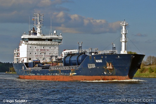
The current position of vessel Manas is 62.6063 lat / 20.0047 lng. Updated: 2024-05-08 02:26:26 UTCCurrently sailing under the flag of Malta
Manas built in 2008 year
Port of registry:
Valletta (capital of Malta)Speed:
14.5 knotDeadweight:
10744 tGross tonnage:
7260Service entry:
2008-01-01T00:00:00ZManufacturer:
Tersan ShipyardDetails:
Last coordinates of the vessel:
UTC, 61.9772, 19.7105, course: 11, speed: 12.5UTC, 62.4058, 19.91, course: 12, speed: 13.3
UTC, 62.4093, 19.9117, course: 12, speed: 13.3
2024-05-08 02:26:26 UTC, 62.6063, 20.0047, course: 12, speed: 13.2