 vesseltracker.com
 Marielyst
Current Status
Where is the vessel?
Marielyst is currently in Near Baarland, based on AIS data received about 1h ago.
Latest AIS update:
Current position: 51.37759° N, 3.93488° E (Near Baarland)
Average speed (last 7 days): Loading…
Average speed (last 30 days): Loading…
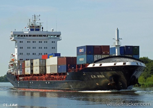
Vessel profile: Marielyst is a Container Ship with dimensions 158m x 24m.
This page combines live AIS, route history, probable destination signals, nearby traffic, and port activity for practical vessel monitoring.
The current position of vessel Marielyst is 51.37759 lat / 3.93488 lng. Updated: 2026-04-04 07:28:18 UTCNearest reference points:
- Near Baarland
- Near Hansweert/Schore
- Near Terneuzen
Currently sailing under the flag of Portugal ![]()
Marielyst built in 2010 year
Deadweight:
14236 tDetails:
Live Vessel Marielyst Analytics (details, animations, etc.)
Recent AIS points (UTC):
2026-04-04 01:49:52 UTC · 51.35271, 4.25582 · SOG 0 kn · COG 292°2026-04-04 03:22:58 UTC · 51.35269, 4.25590 · SOG 0 kn · COG 291°
2026-04-04 06:11:08 UTC · 51.35267, 4.25469 · SOG 3.6 kn · COG 291°
2026-04-04 07:28:18 UTC · 51.37759, 3.93488 · SOG 16.7 kn · COG 232°