 vesseltracker.com
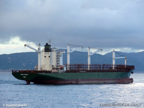
 BHARANI
Current Status
Where is the vessel?
BHARANI is currently in Near Cotonou, based on AIS data received less than 1h ago.
Latest AIS update:
Current position: 6.26167° N, 2.55500° E (Near Cotonou)
Average speed (last 7 days): Loading…
Average speed (last 30 days): Loading…
Vessel profile: BHARANI is a Container Ship with dimensions m x m.
This page combines live AIS, route history, probable destination signals, nearby traffic, and port activity for practical vessel monitoring.
The current position of vessel BHARANI is 6.26167 lat / 2.55500 lng. Updated: 2026-04-03 00:06:21 UTCNearest reference points:
- Near Cotonou
- Near Kirikiri
- Near Apapa
Currently sailing under the flag of Panama ![]()
Details:
Live Vessel BHARANI Analytics (details, animations, etc.)
Recent AIS points (UTC):
2026-04-02 18:16:35 UTC · 6.26341, 2.55531 · SOG 0.2 kn · COG 110°2026-04-02 19:43:38 UTC · 6.26310, 2.55501 · SOG 0 kn · COG 99°
2026-04-02 21:43:38 UTC · 6.26285, 2.55527 · SOG 0 kn · COG 104°
2026-04-03 00:06:21 UTC · 6.26167, 2.55500 · SOG 0 kn · COG -1°