 vesseltracker.com
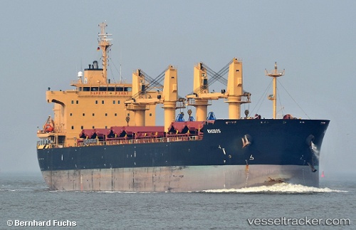
 XIN HAI TONG 66
Current Status
Where is the vessel?
XIN HAI TONG 66 is currently in Near SOKHNA, based on AIS data received about 1d ago.
Latest AIS update:
Current position: 29.69982° N, 32.43287° E (Near SOKHNA)
Average speed (last 7 days): Loading…
Average speed (last 30 days): Loading…
Vessel profile: XIN HAI TONG 66 is a Bulk Carrier with dimensions m x m.
This page combines live AIS, route history, probable destination signals, nearby traffic, and port activity for practical vessel monitoring.
The current position of vessel XIN HAI TONG 66 is 29.69982 lat / 32.43287 lng. Updated: 2026-04-10 07:10:39 UTCNearest reference points:
- Near Al Adabiyah
- Near Ras Sudr
- Near AL ADABIYAH
Currently sailing under the flag of Marshall Islands ![]()
Details:
Live Vessel XIN HAI TONG 66 Analytics (details, animations, etc.)
Recent AIS points (UTC):
2026-04-10 02:07:39 UTC · 29.69985, 32.43283 · SOG 0.1 kn · COG 303°2026-04-10 04:01:39 UTC · 29.69987, 32.43293 · SOG 0 kn · COG 300°
2026-04-10 05:31:39 UTC · 29.70013, 32.43307 · SOG 0.1 kn · COG 295°
2026-04-10 07:10:39 UTC · 29.69982, 32.43287 · SOG 0 kn · COG 308°