 vesseltracker.com
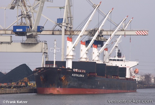
 KEFALONIA
Current Status
Where is the vessel?
KEFALONIA is currently in Near Paranagua, based on AIS data received less than 1h ago.
Latest AIS update:
Current position: 25.49393° S, 48.41992° W (Near Paranagua)
Average speed (last 7 days): Loading…
Average speed (last 30 days): Loading…
Vessel profile: KEFALONIA is a Bulk Carrier with dimensions m x m.
This page combines live AIS, route history, probable destination signals, nearby traffic, and port activity for practical vessel monitoring.
The current position of vessel KEFALONIA is -25.49393 lat / -48.41992 lng. Updated: 2026-04-03 04:05:09 UTCNearest reference points:
- 24 nm E of Caioba
- 32 nm E of Caioba
- 10 nm NE of CAMBORIU
Currently sailing under the flag of Barbados ![]()
Details:
Live Vessel KEFALONIA Analytics (details, animations, etc.)
Recent AIS points (UTC):
2026-04-02 21:38:09 UTC · -25.49445, -48.41647 · SOG 0 kn · COG 275°2026-04-03 00:02:09 UTC · -25.49515, -48.41725 · SOG 0.1 kn · COG 324°
2026-04-03 02:05:09 UTC · -25.49527, -48.41922 · SOG 0 kn · COG 42°
2026-04-03 04:05:09 UTC · -25.49393, -48.41992 · SOG 0 kn · COG 81°