 vesseltracker.com
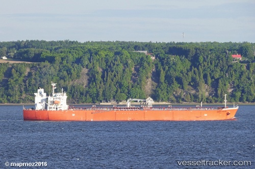
 ATAHUALPA
Current Status
Where is the vessel?
ATAHUALPA is currently in Near Yanbu Industrial City, based on AIS data received about 1h ago.
Latest AIS update:
Current position: 23.94962° N, 38.23387° E (Near Yanbu Industrial City)
Average speed (last 7 days): Loading…
Average speed (last 30 days): Loading…
Vessel profile: ATAHUALPA is a Oil Products Tanker with dimensions 180m x 32m.
This page combines live AIS, route history, probable destination signals, nearby traffic, and port activity for practical vessel monitoring.
The current position of vessel ATAHUALPA is 23.94962 lat / 38.23387 lng. Updated: 2026-03-26 21:34:55 UTCNearest reference points:
- 30 nm SW of Yanbu
- 42 nm NW of Fiji
- 35 nm S of Umm Lajj
Currently sailing under the flag of Marshall Islands ![]()
ATAHUALPA built in 2010 year
Deadweight:
46549 tDetails:
Live Vessel ATAHUALPA Analytics (details, animations, etc.)
Recent AIS points (UTC):
2026-03-26 16:00:14 UTC · 23.94108, 38.19377 · SOG 0 kn · COG 301°2026-03-26 18:00:13 UTC · 23.94177, 38.19238 · SOG 0.4 kn · COG 318°
2026-03-26 19:30:40 UTC · 23.94967, 38.23388 · SOG 0 kn · COG -1°
2026-03-26 21:34:55 UTC · 23.94962, 38.23387 · SOG 0 kn · COG 270°