 vesseltracker.com
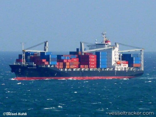
 Callao Bridge
Current Status
Where is the vessel?
Callao Bridge is currently in 49 nm NE of Kampung Tanjung Langsat, based on AIS data received about 1h ago.
Latest AIS update:
Current position: 2.11234° N, 104.50638° E (49 nm NE of Kampung Tanjung Langsat)
Average speed (last 7 days): Loading…
Average speed (last 30 days): Loading…
Vessel profile: Callao Bridge is a Container Ship with dimensions 199m x 32m.
This page combines live AIS, route history, probable destination signals, nearby traffic, and port activity for practical vessel monitoring.
The current position of vessel Callao Bridge is 2.11234 lat / 104.50638 lng. Updated: 2026-03-27 08:09:19 UTCNearest reference points:
- 47 nm NE of PENGERANG
- 52 nm NE of PENGERANG
- 53 nm NE of PENGERANG
Currently sailing under the flag of Panama ![]()
Callao Bridge built in 2010 year
Deadweight:
33008 tDetails:
Live Vessel Callao Bridge Analytics (details, animations, etc.)
Recent AIS points (UTC):
2026-03-27 03:28:47 UTC · 1.25225, 104.13462 · SOG 16.3 kn · COG 82°2026-03-27 03:28:47 UTC · 1.25225, 104.13462 · SOG 16.3 kn · COG 82°
2026-03-27 05:22:52 UTC · 1.49073, 104.55275 · SOG 15.1 kn · COG 46°
2026-03-27 08:09:19 UTC · 2.11234, 104.50638 · SOG 13.4 kn · COG 346°