 vesseltracker.com
 JENGGALA 21
Current Status
Where is the vessel?
JENGGALA 21 is currently in 61 nm S of Baco, based on AIS data received less than 1h ago.
Latest AIS update:
Current position: 7.08738° N, 82.57313° W (61 nm S of Baco)
Average speed (last 7 days): Loading…
Average speed (last 30 days): Loading…
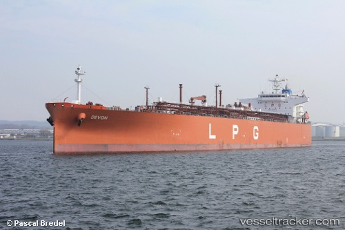
Vessel profile: JENGGALA 21 is a Lpg Tanker with dimensions m x m.
This page combines live AIS, route history, probable destination signals, nearby traffic, and port activity for practical vessel monitoring.
The current position of vessel JENGGALA 21 is 7.08738 lat / -82.57313 lng. Updated: 2026-03-31 17:45:13 UTCNearest reference points:
- 20 nm S of El Puerto
- Near Chiriquí Grande
Currently sailing under the flag of Indonesia ![]()
Details:
Live Vessel JENGGALA 21 Analytics (details, animations, etc.)
Recent AIS points (UTC):
2026-03-31 11:35:09 UTC · 6.98503, -81.03628 · SOG 15.1 kn · COG 270°2026-03-31 14:21:54 UTC · 6.96052, -81.74396 · SOG 15.4 kn · COG 271°
2026-03-31 15:34:07 UTC · 6.95705, -82.05349 · SOG 14.7 kn · COG 271°
2026-03-31 17:45:13 UTC · 7.08738, -82.57313 · SOG 14.5 kn · COG 290°