 vesseltracker.com
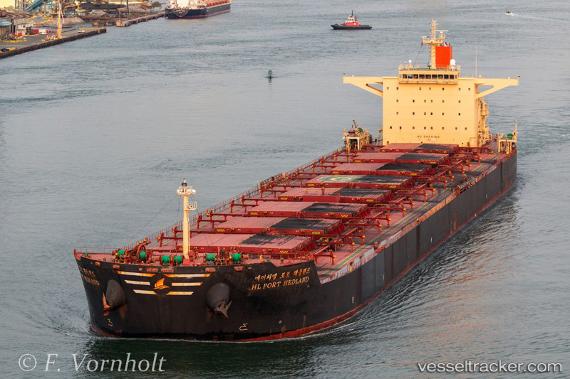
 HL PORT HEDLAND
Current Status
Where is the vessel?
HL PORT HEDLAND is currently in Near DALRYMPLE, based on AIS data received about 1h ago.
Latest AIS update:
Current position: 21.24358° S, 149.30263° E (Near DALRYMPLE)
Average speed (last 7 days): Loading…
Average speed (last 30 days): Loading…
Vessel profile: HL PORT HEDLAND is a Cargo with dimensions m x m.
This page combines live AIS, route history, probable destination signals, nearby traffic, and port activity for practical vessel monitoring.
The current position of vessel HL PORT HEDLAND is -21.24358 lat / 149.30263 lng. Updated: 2026-04-08 16:07:12 UTCNearest reference points:
- Near Mackay
- Near Whitsunday Island
- Near Abell Point
Currently sailing under the flag of Liberia ![]()
Details:
Live Vessel HL PORT HEDLAND Analytics (details, animations, etc.)
Recent AIS points (UTC):
2026-04-08 10:14:44 UTC · -21.24340, 149.30168 · SOG 0 kn · COG 150°2026-04-08 12:11:48 UTC · -21.24342, 149.30168 · SOG 0 kn · COG 150°
2026-04-08 14:05:49 UTC · -21.24343, 149.30173 · SOG 0 kn · COG 150°
2026-04-08 16:07:12 UTC · -21.24358, 149.30263 · SOG 1.1 kn · COG 138°