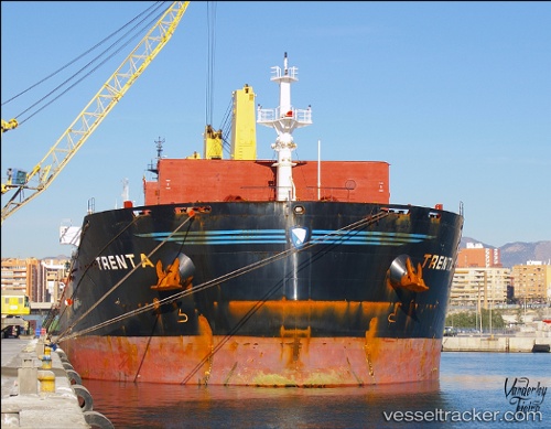
.
Vessel photo of MANALAGI VIRA (IMO 9456159) vesseltracker.com

ID flag MANALAGI VIRA

Vessel type: Bulk Carrier | IMO: 9456159 | MMSI: MMSI: 525900437
Call sign: YDAJ2 | Dimensions: 32 m x 190 m
Current Status

Where is the vessel?

MANALAGI VIRA is currently in Near CILACAP, based on AIS data received less than 1h ago.

Latest AIS update:

Current position: 7.69484° S, 109.08895° E (Near CILACAP)

Average speed (last 7 days): Loading…

Average speed (last 30 days): Loading…

Vessel profile: MANALAGI VIRA is a Bulk Carrier with dimensions 32m x 190m.

This page combines live AIS, route history, probable destination signals, nearby traffic, and port activity for practical vessel monitoring.

The current position of vessel MANALAGI VIRA is -7.69484 lat / 109.08895 lng. Updated: 2026-04-01 15:35:46 UTC
Nearest reference points:
  • Near Batang
  • 26 nm N of Pemalang
  • 25 nm N of Gunungsari

Currently sailing under the flag of Indonesia ID flag

MANALAGI VIRA built in 2010 year

Deadweight:
56838 t

Details:

Live Vessel MANALAGI VIRA Analytics (details, animations, etc.)


Recent AIS points (UTC):
2026-04-01 08:05:35 UTC · -7.69478, 109.08893 · SOG 0 kn · COG 68°
2026-04-01 11:29:38 UTC · -7.69474, 109.08893 · SOG 0.1 kn · COG 68°
2026-04-01 13:41:42 UTC · -7.69476, 109.08890 · SOG 0.2 kn · COG 68°
2026-04-01 15:35:46 UTC · -7.69484, 109.08895 · SOG 0 kn · COG 68°

Track of the vessel in the last 60 days


UTC: --
Start: -- Track timeline (UTC) End: --
Encountered: --


Link to the map:


Find another ship

MANALAGI_VIRA (525900437) last ports (portcalls and passsages)

Muara Pantai | 2025-08-28 12:26:25
Muara Pantai | 2025-08-24 12:25:27
Taboneo | 2025-08-09 11:13:50
Taboneo | 2025-08-05 01:22:39
GILIMANUK | 2025-08-04 02:16:18
BANYUWANGI | 2025-08-04 00:43:46
Tjilatjap | 2025-08-02 15:01:56
CILACAP | 2025-08-01 06:07:32
CILACAP | 2025-07-28 05:19:48
Panjang | 2025-07-27 00:44:44
CIWANDAN | 2025-07-26 20:43:07
SURALAYA | 2025-07-26 19:39:35
Tanjung Priok | 2025-07-17 05:21:06
SURALAYA | 2025-07-13 17:45:21
SURALAYA | 2025-07-09 17:21:56
Taboneo | 2025-06-16 16:18:27
Taboneo | 2025-06-12 16:04:36
Taboneo | 2025-06-08 15:26:08
Taboneo | 2025-06-04 15:19:34
Taboneo | 2025-05-31 14:01:04
Taboneo | 2025-05-23 13:47:50
Taboneo | 2025-05-19 12:57:58
Taboneo | 2025-05-15 11:50:28
SURALAYA | 2025-05-08 15:54:14
SURALAYA | 2025-05-04 15:25:28
Muara Pantai | 2025-04-29 16:02:00
Muara Pantai | 2025-04-25 15:20:23
Tanjung Priok | 2025-04-20 21:13:43
SURALAYA | 2025-04-16 15:27:54
SURALAYA | 2025-04-12 14:15:53
Tanjung Priok | 2025-03-22 07:00:56
CILEGON | 2025-03-20 14:27:37
CILEGON | 2025-02-24 09:38:13
CILEGON | 2025-02-20 09:02:42
MERAK | 2025-02-18 21:16:55
SURALAYA | 2025-02-16 14:28:56
MERAK | 2025-02-14 21:00:15
SURALAYA | 2025-02-12 12:48:44
Tanjung Priok | 2025-01-28 22:04:31
MERAK | 2025-01-27 22:00:01
SURALAYA | 2025-01-27 20:14:09
MERAK | 2025-01-23 21:14:25
SURALAYA | 2025-01-23 19:46:31
Muara Pantai | 2024-12-22 13:55:16
Muara Pantai | 2024-12-18 13:13:58
Taboneo | 2024-11-04 14:09:52
Taboneo | 2024-10-31 13:21:17
Selat Lombok | 2024-10-30 06:28:34
Tjilatjap | 2024-10-25 14:15:05
Selat Lombok | 2024-07-29 16:29:02
Selat Lombok | 2024-07-21 09:26:56
Senipah Oil Terminal | 2024-06-09 09:02:27
Senipah Oil Terminal | 2024-06-05 08:21:39
Senipah Oil Terminal | 2024-05-01 12:28:39
Senipah Oil Terminal | 2024-04-27 11:11:33
Senipah Oil Terminal | 2024-04-23 11:02:50
Senipah Oil Terminal | 2024-04-09 00:12:04
Senipah Oil Terminal | 2024-04-04 23:22:33
Panjang | 2023-08-17 19:10:59
Tjilatjap | 2023-08-11 01:05:42
Selat Lombok | 2023-08-01 13:15:29
Selat Lombok | 2023-07-25 03:22:03
Selat Lombok | 2023-07-16 04:29:23
Sambu | 2023-05-03 22:27:25
Singapore | 2023-03-22 23:02:26