 vesseltracker.com
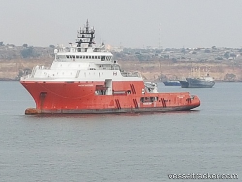
 PACIFIC DISCOVERY
Current Status
Where is the vessel?
PACIFIC DISCOVERY is currently in 17 nm W of Helgoland, based on AIS data received about 17h ago.
Latest AIS update:
Current position: 54.05829° N, 7.43200° E (17 nm W of Helgoland)
Average speed (last 7 days): Loading…
Average speed (last 30 days): Loading…
Vessel profile: PACIFIC DISCOVERY is a Anchor Handling Vessel with dimensions m x m.
This page combines live AIS, route history, probable destination signals, nearby traffic, and port activity for practical vessel monitoring.
The current position of vessel PACIFIC DISCOVERY is 54.05829 lat / 7.43200 lng. Updated: 2026-04-10 07:23:22 UTCNearest reference points:
- Near Helgoland
- Near Wangerooge
- Near NORDERNEY
Currently sailing under the flag of United Kingdom ![]()
Details:
Live Vessel PACIFIC DISCOVERY Analytics (details, animations, etc.)
Recent AIS points (UTC):
2026-04-10 02:23:17 UTC · 54.05815, 7.43196 · SOG 0.8 kn · COG 245°2026-04-10 03:49:13 UTC · 54.05739, 7.43199 · SOG 1.1 kn · COG 321°
2026-04-10 05:55:18 UTC · 54.05787, 7.43211 · SOG 0.8 kn · COG 315°
2026-04-10 07:23:22 UTC · 54.05829, 7.43200 · SOG 0.2 kn · COG 283°