 vesseltracker.com
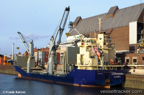
 MERATUS PROJECT PRIMA
Current Status
Where is the vessel?
MERATUS PROJECT PRIMA is currently in 54 nm SE of Pagerungan, based on AIS data received about 1h ago.
Latest AIS update:
Current position: 7.41667° S, 116.67833° E (54 nm SE of Pagerungan)
Average speed (last 7 days): Loading…
Average speed (last 30 days): Loading…
Vessel profile: MERATUS PROJECT PRIMA is a General Cargo Ship with dimensions 108m x 17m.
This page combines live AIS, route history, probable destination signals, nearby traffic, and port activity for practical vessel monitoring.
The current position of vessel MERATUS PROJECT PRIMA is -7.41667 lat / 116.67833 lng. Updated: 2026-03-31 10:02:28 UTCNearest reference points:
- 37 nm E of Pagerungan
- 74 nm NE of Pagerungan
- 29 nm N of MANGGIS
Currently sailing under the flag of Indonesia ![]()
MERATUS PROJECT PRIMA built in 2011 year
Deadweight:
5627 tDetails:
Live Vessel MERATUS PROJECT PRIMA Analytics (details, animations, etc.)
Recent AIS points (UTC):
2026-03-31 03:26:26 UTC · -8.29333, 116.81167 · SOG 8 kn · COG -1°2026-03-31 05:35:29 UTC · -7.98333, 116.75833 · SOG 8 kn · COG -1°
2026-03-31 07:35:30 UTC · -7.72500, 116.72333 · SOG 7 kn · COG -1°
2026-03-31 10:02:28 UTC · -7.41667, 116.67833 · SOG 7 kn · COG -1°