 vesseltracker.com
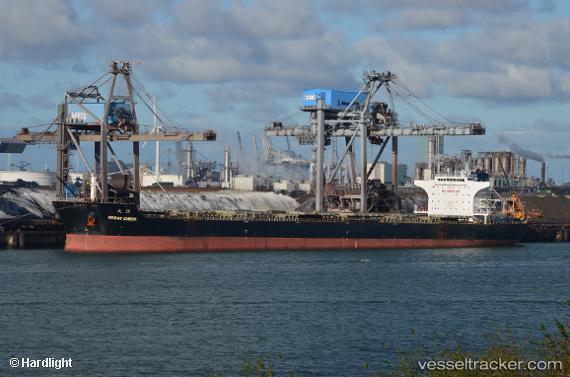
 REACHY SUMMER
Current Status
Where is the vessel?
REACHY SUMMER is currently in 69 nm N of Pinelands, based on AIS data received about 2h ago.
Latest AIS update:
Current position: 35.04540° N, 18.76482° E (69 nm N of Pinelands)
Average speed (last 7 days): Loading…
Average speed (last 30 days): Loading…
Vessel profile: REACHY SUMMER is a Bulk Carrier with dimensions 38m x 230m.
This page combines live AIS, route history, probable destination signals, nearby traffic, and port activity for practical vessel monitoring.
The current position of vessel REACHY SUMMER is 35.04540 lat / 18.76482 lng. Updated: 2026-04-06 09:01:11 UTCNearest reference points:
- 71 nm N of Pinelands
- 73 nm N of Pinelands
- 103 nm NE of Ryuo
Currently sailing under the flag of Marshall Islands ![]()
REACHY SUMMER built in 2009 year
Deadweight:
93297 tDetails:
Live Vessel REACHY SUMMER Analytics (details, animations, etc.)
Recent AIS points (UTC):
2026-04-05 14:07:17 UTC · 34.08846, 23.26624 · SOG 11.9 kn · COG 287°2026-04-05 14:07:17 UTC · 34.08846, 23.26624 · SOG 11.9 kn · COG 287°
2026-04-06 07:38:48 UTC · 34.97301, 19.10139 · SOG 12.4 kn · COG 286°
2026-04-06 09:01:11 UTC · 35.04540, 18.76482 · SOG 12.3 kn · COG 284°