 vesseltracker.com
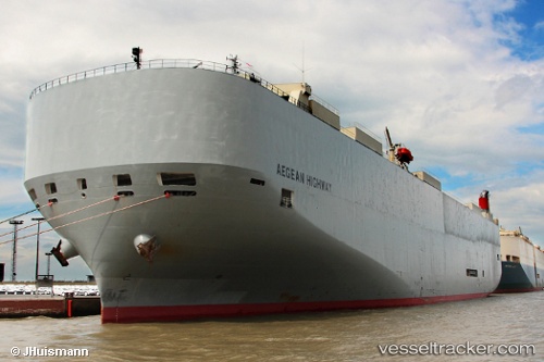
 Aegean Highway
Current Status
Where is the vessel?
Aegean Highway is currently in 155 nm S of Morro Redondo, based on AIS data received about 2h ago.
Latest AIS update:
Current position: 25.54375° N, 115.85982° W (155 nm S of Morro Redondo)
Average speed (last 7 days): Loading…
Average speed (last 30 days): Loading…
Vessel profile: Aegean Highway is a Vehicles Carrier with dimensions 199m x 32m.
This page combines live AIS, route history, probable destination signals, nearby traffic, and port activity for practical vessel monitoring.
The current position of vessel Aegean Highway is 25.54375 lat / -115.85982 lng. Updated: 2026-03-28 07:44:18 UTCCurrently sailing under the flag of Japan ![]()
Aegean Highway built in 2008 year
Deadweight:
18867 tDetails:
Live Vessel Aegean Highway Analytics (details, animations, etc.)
Recent AIS points (UTC):
2026-03-28 02:36:59 UTC · 26.14452, -117.16242 · SOG 15.1 kn · COG 118°2026-03-28 03:29:11 UTC · 26.04208, -116.94192 · SOG 15.2 kn · COG 117°
2026-03-28 06:03:53 UTC · 25.74382, -116.28530 · SOG 15.6 kn · COG 116°
2026-03-28 07:44:18 UTC · 25.54375, -115.85982 · SOG 15.4 kn · COG 114°