 vesseltracker.com
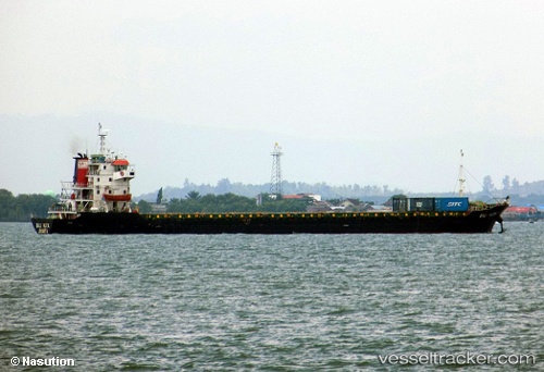
Mv. Bali Kuta
Current StatusWhere is the vessel?
Mv. Bali Kuta is currently in 37 nm E of RAHA, based on AIS data received about 13h ago.
Latest AIS update:
Current position: 5.06909° S, 123.29963° E (37 nm E of RAHA)
Average speed (last 7 days): Loading…
Average speed (last 30 days): Loading…
Vessel profile: Mv. Bali Kuta is a General Cargo Ship with dimensions 22m x 97m.
This page combines live AIS, route history, probable destination signals, nearby traffic, and port activity for practical vessel monitoring.
The current position of vessel Mv. Bali Kuta is -5.06909 lat / 123.29963 lng. Updated: 2026-04-01 15:32:54 UTCNearest reference points:
- Near BAUBAU
- Near Labuan
- 11 nm NW of KENDARI
Details:
Live Vessel Mv. Bali Kuta Analytics (details, animations, etc.)
Recent AIS points (UTC):
2026-04-01 14:23:21 UTC · -5.24930, 123.30043 · SOG 8.9 kn · COG 4°2026-04-01 15:32:54 UTC · -5.06909, 123.29963 · SOG 9.2 kn · COG 5°
2026-04-01 15:32:54 UTC · -5.06909, 123.29963 · SOG 9.2 kn · COG 5°
2026-04-01 15:32:54 UTC · -5.06909, 123.29963 · SOG 9.2 kn · COG 5°