 vesseltracker.com
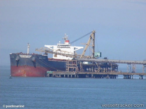
 ATALANDI
Current Status
Where is the vessel?
ATALANDI is currently in Near Buchanan, based on AIS data received about 1h ago.
Latest AIS update:
Current position: 5.84314° N, 10.08682° W (Near Buchanan)
Average speed (last 7 days): Loading…
Average speed (last 30 days): Loading…
Vessel profile: ATALANDI is a Bulk Carrier with dimensions 45m x 292m.
This page combines live AIS, route history, probable destination signals, nearby traffic, and port activity for practical vessel monitoring.
The current position of vessel ATALANDI is 5.84314 lat / -10.08682 lng. Updated: 2026-04-20 19:49:24 UTCNearest reference points:
- 15 nm SW of Buchanan
- 110 nm SW of River Cess
- 98 nm SW of Harper
Currently sailing under the flag of Malta ![]()
ATALANDI built in 2010 year
Deadweight:
179329 tDetails:
Live Vessel ATALANDI Analytics (details, animations, etc.)
Recent AIS points (UTC):
2026-04-20 16:52:22 UTC · 5.84107, -10.08328 · SOG 0 kn · COG 271°2026-04-20 17:28:22 UTC · 5.84202, -10.08343 · SOG 0.1 kn · COG 254°
2026-04-20 19:10:24 UTC · 5.84343, -10.08558 · SOG 0 kn · COG 183°
2026-04-20 19:49:24 UTC · 5.84314, -10.08682 · SOG 0 kn · COG 144°