 vesseltracker.com
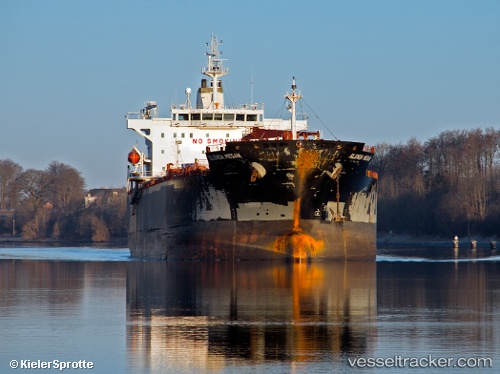
 MARIA MAJESTY
Current Status
Where is the vessel?
MARIA MAJESTY is currently in 103 nm W of Al Qunfudah, based on AIS data received less than 1h ago.
Latest AIS update:
Current position: 18.53196° N, 39.35790° E (103 nm W of Al Qunfudah)
Average speed (last 7 days): Loading…
Average speed (last 30 days): Loading…
Vessel profile: MARIA MAJESTY is a Chemical/Oil Products Tanker with dimensions 182m x 34m.
This page combines live AIS, route history, probable destination signals, nearby traffic, and port activity for practical vessel monitoring.
The current position of vessel MARIA MAJESTY is 18.53196 lat / 39.35790 lng. Updated: 2026-04-03 06:11:02 UTCNearest reference points:
- 99 nm SW of Al Qunfudah
- 53 nm SW of SHUAIBAH
- 92 nm SW of Al Qahmah
Currently sailing under the flag of Marshall Islands ![]()
MARIA MAJESTY built in 2009 year
Deadweight:
47147 tDetails:
Live Vessel MARIA MAJESTY Analytics (details, animations, etc.)
Recent AIS points (UTC):
2026-04-02 23:36:03 UTC · 19.49705, 38.79600 · SOG 11.2 kn · COG 163°2026-04-03 01:51:02 UTC · 19.08244, 38.90843 · SOG 8.9 kn · COG 174°
2026-04-03 03:56:02 UTC · 18.86145, 39.08432 · SOG 11.2 kn · COG 145°
2026-04-03 06:11:02 UTC · 18.53196, 39.35790 · SOG 11 kn · COG 141°