 vesseltracker.com
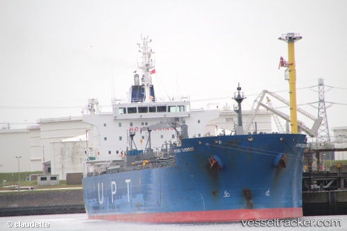
 SAN MARTIN
Current Status
Where is the vessel?
SAN MARTIN is currently in 13 nm E of Il-Kappara, based on AIS data received about 2h ago.
Latest AIS update:
Current position: 35.85950° N, 14.83708° E (13 nm E of Il-Kappara)
Average speed (last 7 days): Loading…
Average speed (last 30 days): Loading…
Vessel profile: SAN MARTIN is a Oil/Chemical Tanker with dimensions m x m.
This page combines live AIS, route history, probable destination signals, nearby traffic, and port activity for practical vessel monitoring.
The current position of vessel SAN MARTIN is 35.85950 lat / 14.83708 lng. Updated: 2026-04-07 01:27:01 UTCNearest reference points:
- 13 nm E of Il-Kappara
- 18 nm E of Il-Kappara
- Near Xghajra
Currently sailing under the flag of Malta ![]()
Details:
Live Vessel SAN MARTIN Analytics (details, animations, etc.)
Recent AIS points (UTC):
2026-04-06 19:39:16 UTC · 35.85899, 14.83672 · SOG 0.1 kn · COG 326°2026-04-06 21:47:59 UTC · 35.85935, 14.83700 · SOG 0.3 kn · COG 305°
2026-04-06 23:30:01 UTC · 35.85950, 14.83715 · SOG 0 kn · COG 298°
2026-04-07 01:27:01 UTC · 35.85950, 14.83708 · SOG 0.2 kn · COG 290°