 vesseltracker.com
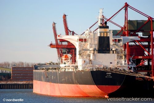
 Rutland
Current Status
Where is the vessel?
Rutland is currently in 29 nm W of Salomague, based on AIS data received about 1h ago.
Latest AIS update:
Current position: 17.90167° N, 119.91667° E (29 nm W of Salomague)
Average speed (last 7 days): Loading…
Average speed (last 30 days): Loading…
Vessel profile: Rutland is a Bulk Carrier with dimensions 292m x 45m.
This page combines live AIS, route history, probable destination signals, nearby traffic, and port activity for practical vessel monitoring.
The current position of vessel Rutland is 17.90167 lat / 119.91667 lng. Updated: 2026-04-02 23:55:23 UTCNearest reference points:
- 22 nm W of Salomague
- 138 nm NW of Bolinao
- 66 nm W of Basco
Currently sailing under the flag of Liberia ![]()
Rutland built in 2009 year
Deadweight:
178031 tDetails:
Live Vessel Rutland Analytics (details, animations, etc.)
Recent AIS points (UTC):
2026-04-02 17:19:14 UTC · 16.75333, 119.45833 · SOG 11 kn · COG -1°2026-04-02 19:37:15 UTC · 17.14667, 119.60667 · SOG 10 kn · COG -1°
2026-04-02 21:47:24 UTC · 17.52645, 119.75205 · SOG 11.4 kn · COG -1°
2026-04-02 23:55:23 UTC · 17.90167, 119.91667 · SOG 11 kn · COG -1°