 vesseltracker.com
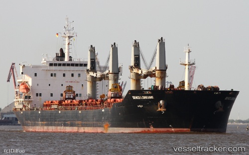
 AFRICA HOPE
Current Status
Where is the vessel?
AFRICA HOPE is currently in Near Calabar, based on AIS data received about 1h ago.
Latest AIS update:
Current position: 5.01254° N, 8.31627° E (Near Calabar)
Average speed (last 7 days): Loading…
Average speed (last 30 days): Loading…
Vessel profile: AFRICA HOPE is a Bulk Carrier with dimensions 189m x 32m.
This page combines live AIS, route history, probable destination signals, nearby traffic, and port activity for practical vessel monitoring.
The current position of vessel AFRICA HOPE is 5.01254 lat / 8.31627 lng. Updated: 2026-04-14 17:43:36 UTCNearest reference points:
- Near Calabar
- Near Moudi Terminal
- Near Odudu Terminal
Currently sailing under the flag of Panama ![]()
AFRICA HOPE built in 2009 year
Deadweight:
53416 tDetails:
Live Vessel AFRICA HOPE Analytics (details, animations, etc.)
Recent AIS points (UTC):
2026-04-14 11:49:31 UTC · 5.01250, 8.31627 · SOG 0 kn · COG 352°2026-04-14 13:34:31 UTC · 5.01252, 8.31623 · SOG 0 kn · COG 352°
2026-04-14 15:52:33 UTC · 5.01251, 8.31626 · SOG 0 kn · COG 352°
2026-04-14 17:43:36 UTC · 5.01254, 8.31627 · SOG 0 kn · COG 352°