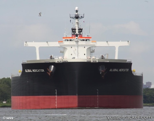
.
Vessel photo of FREEDOM (IMO 9479216) vesseltracker.com

BS flag FREEDOM

Vessel type: Bulk Carrier | IMO: 9479216 | MMSI: MMSI: 311000926
Call sign: C6EL3 | Dimensions: 292 m x 45 m
Current Status

Where is the vessel?

FREEDOM is currently in Near Mangaratiba, based on AIS data received about 1h ago.

Latest AIS update:

Current position: 22.96902° S, 43.94814° W (Near Mangaratiba)

Average speed (last 7 days): Loading…

Average speed (last 30 days): Loading…

Vessel profile: FREEDOM is a Bulk Carrier with dimensions 292m x 45m.

This page combines live AIS, route history, probable destination signals, nearby traffic, and port activity for practical vessel monitoring.

The current position of vessel FREEDOM is -22.96902 lat / -43.94814 lng. Updated: 2026-03-26 05:52:28 UTC
Nearest reference points:
  • Near ILHA GUAIBA
  • Near SANTA RITA
  • Near CUNHAMBEBE

Currently sailing under the flag of Bahamas BS flag

FREEDOM built in 2011 year

Deadweight:
182205 t

Details:

Live Vessel FREEDOM Analytics (details, animations, etc.)


Recent AIS points (UTC):
2026-03-25 23:52:23 UTC · -22.96908, -43.94793 · SOG 0 kn · COG 72°
2026-03-26 01:43:23 UTC · -22.96743, -43.94310 · SOG 0.1 kn · COG 244°
2026-03-26 03:55:26 UTC · -22.97010, -43.94768 · SOG 0.2 kn · COG 44°
2026-03-26 05:52:28 UTC · -22.96902, -43.94814 · SOG 0 kn · COG 82°

Track of the vessel in the last 28 days


UTC: --
Start: -- Track timeline (UTC) End: --
Encountered: --


Link to the map:


Find another ship

FREEDOM (311000926) last ports (portcalls and passsages)

HAMBANTOTA | 2025-07-30 09:14:16
JAIGAD | 2025-07-25 00:19:58
JAIGAD | 2025-07-20 23:23:56
BUKOM ISLAND | 2025-05-03 08:17:30
TANAH MERAH | 2025-05-02 19:25:55
PENGERANG | 2025-05-02 17:19:04
Fangcheng | 2025-03-12 21:17:31
PENGERANG | 2025-03-07 11:58:58
TANAH MERAH | 2025-03-06 23:16:10
PULAU SAMBU | 2025-03-06 21:58:55
SALDANHA | 2025-02-10 05:56:02
Saldanha Bay | 2025-02-10 00:08:05
DHAMRA | 2025-01-08 12:15:44
Richards Bay | 2024-12-20 00:56:05
Richards Bay | 2024-12-16 00:19:52
DHAMRA | 2024-11-22 20:30:47
Richards Bay | 2024-11-03 03:25:02
Fateh Terminal | 2024-10-17 19:23:48
Sitrah Anchorage | 2024-10-15 04:45:19
Sitrah Anchorage | 2024-10-11 04:35:22
Singapore | 2024-07-30 22:24:28
Sambu | 2024-07-30 12:41:45
Wusong | 2024-07-20 21:55:17
Taixing | 2024-07-18 02:59:20
Zhangjiagang | 2024-07-17 21:39:15
Nantong | 2024-07-17 18:48:37
Taicang | 2024-07-17 14:43:45
Jingjiang | 2024-07-17 07:30:03
Sambu | 2024-07-05 02:48:17
Saldanha Bay | 2024-06-09 06:39:36
Sambu | 2024-05-19 03:02:21
Singapore | 2024-05-18 11:55:29
Newcastle | 2024-04-19 19:44:28
Port Kembla | 2024-04-15 09:54:55
Port Kembla | 2024-04-11 09:36:02
Port Kembla | 2024-04-07 09:03:29
Nouadhibou | 2024-02-13 13:05:51
Nouadhibou | 2024-02-09 12:25:27
Port Etienne | 2024-02-09 09:12:29
Strait Of Gibraltar | 2024-02-05 13:24:46
Cagliari | 2024-02-02 12:18:32
Port Said | 2024-01-28 14:43:23
Bur Ibrahim | 2024-01-28 04:43:10
Ayn Sukhnah | 2024-01-27 07:11:30
Ayn Sukhnah | 2024-01-10 17:55:17
Fateh Terminal | 2023-12-26 10:15:58
Sitrah Anchorage | 2023-12-24 16:56:41
Sitrah Anchorage | 2023-12-20 15:47:27
Fujairah | 2023-10-16 04:14:18
Sitrah Anchorage | 2023-10-14 10:23:24
Sitrah Anchorage | 2023-10-10 09:32:22
Singapore | 2023-07-30 23:54:36
Selat Lombok | 2023-07-14 20:30:54
Dampier | 2023-07-11 04:40:29
Selat Lombok | 2023-07-05 21:56:16
Sebang | 2023-06-06 06:59:59
Ras Gharib | 2023-05-22 00:49:42
Ayn Sukhnah | 2023-05-21 17:52:43
Bur Ibrahim | 2023-05-21 15:13:29
Port Said | 2023-05-21 04:32:55
Narvik | 2023-05-01 13:27:05
Narvik | 2023-04-27 11:58:06
Narvik | 2023-04-23 11:25:21
Ijmuiden | 2023-04-17 18:15:37
Ijmuiden | 2023-04-13 17:24:21
Ra’S Shukhayr | 2023-02-07 02:33:08
Fujairah | 2022-12-31 14:53:21
Sitrah Anchorage | 2022-12-21 11:34:52
Singapore | 2022-09-23 07:15:43
Sambu | 2022-06-17 07:16:31
Port Etienne | 2022-01-30 17:02:06
Nouadhibou | 2022-01-24 17:28:37
Port Etienne | 2022-01-02 23:34:37