 vesseltracker.com
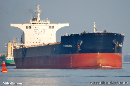
 PANORMOS
Current Status
Where is the vessel?
PANORMOS is currently in 29 nm SE of Bolt Head, based on AIS data received about 1h ago.
Latest AIS update:
Current position: 49.84151° N, 3.32975° W (29 nm SE of Bolt Head)
Average speed (last 7 days): Loading…
Average speed (last 30 days): Loading…
Vessel profile: PANORMOS is a Bulk Carrier with dimensions m x m.
This page combines live AIS, route history, probable destination signals, nearby traffic, and port activity for practical vessel monitoring.
The current position of vessel PANORMOS is 49.84151 lat / -3.32975 lng. Updated: 2026-04-02 10:11:07 UTCNearest reference points:
- 16 nm SE of Brixham
- 23 nm NW of Saint Sampson
- Near Dartmouth
Currently sailing under the flag of Liberia ![]()
Details:
Live Vessel PANORMOS Analytics (details, animations, etc.)
Recent AIS points (UTC):
2026-04-02 03:42:18 UTC · 50.19724, -1.79140 · SOG 12.7 kn · COG 252°2026-04-02 05:45:28 UTC · 50.08897, -2.36548 · SOG 9.3 kn · COG 256°
2026-04-02 08:02:29 UTC · 50.00682, -2.85954 · SOG 8.6 kn · COG 254°
2026-04-02 10:11:07 UTC · 49.84151, -3.32975 · SOG 11 kn · COG 242°