 vesseltracker.com
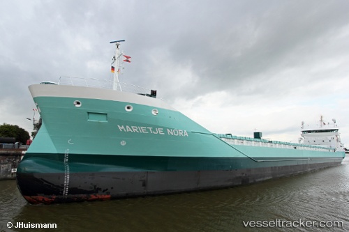
 Marietje Nora
Current Status
Where is the vessel?
Marietje Nora is currently in 59 nm W of Rauma, based on AIS data received about 1h ago.
Latest AIS update:
Current position: 61.29413° N, 19.42436° E (59 nm W of Rauma)
Average speed (last 7 days): Loading…
Average speed (last 30 days): Loading…
Vessel profile: Marietje Nora is a Multi Purpose Carrier with dimensions 136m x 136m.
This page combines live AIS, route history, probable destination signals, nearby traffic, and port activity for practical vessel monitoring.
The current position of vessel Marietje Nora is 61.29413 lat / 19.42436 lng. Updated: 2026-03-25 23:37:17 UTCNearest reference points:
- Near Finström
- Near MARIEHAMN
- Near Maarianhamina (Mariehamn)
Currently sailing under the flag of Netherlands ![]()
Details:
Live Vessel Marietje Nora Analytics (details, animations, etc.)
Recent AIS points (UTC):
2026-03-25 18:20:31 UTC · 60.27842, 19.03382 · SOG 11.7 kn · COG 346°2026-03-25 19:34:11 UTC · 60.51568, 19.05371 · SOG 11.6 kn · COG 12°
2026-03-25 21:39:01 UTC · 60.91088, 19.22912 · SOG 11.9 kn · COG 15°
2026-03-25 23:37:17 UTC · 61.29413, 19.42436 · SOG 11.3 kn · COG -1°