 vesseltracker.com
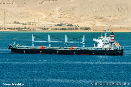
 ANNA DOROTHEA
Current Status
Where is the vessel?
ANNA DOROTHEA is currently in 40 nm SE of San Clodio, based on AIS data received less than 1h ago.
Latest AIS update:
Current position: 48.14733° N, 6.42321° W (40 nm SE of San Clodio)
Average speed (last 7 days): Loading…
Average speed (last 30 days): Loading…
Vessel profile: ANNA DOROTHEA is a Bulk Carrier with dimensions m x m.
This page combines live AIS, route history, probable destination signals, nearby traffic, and port activity for practical vessel monitoring.
The current position of vessel ANNA DOROTHEA is 48.14733 lat / -6.42321 lng. Updated: 2026-03-29 05:54:24 UTCNearest reference points:
- 35 nm SW of Ile D’Ouessant
- 60 nm SE of San Clodio
- 46 nm W of SEIN
Currently sailing under the flag of Liberia ![]()
Details:
Live Vessel ANNA DOROTHEA Analytics (details, animations, etc.)
Recent AIS points (UTC):
2026-03-29 00:11:04 UTC · 48.91988, -5.69863 · SOG 10.4 kn · COG 240°2026-03-29 01:10:25 UTC · 48.79282, -5.86203 · SOG 11.3 kn · COG 209°
2026-03-29 03:27:44 UTC · 48.57821, -6.04687 · SOG 11.6 kn · COG 213°
2026-03-29 05:54:24 UTC · 48.14733, -6.42321 · SOG 12.5 kn · COG 212°