 vesseltracker.com
 PRINCESS MARIA
Current Status
Where is the vessel?
PRINCESS MARIA is currently in 13 nm SE of Taganito, based on AIS data received about 6h ago.
Latest AIS update:
Current position: 9.38167° N, 125.95167° E (13 nm SE of Taganito)
Average speed (last 7 days): Loading…
Average speed (last 30 days): Loading…
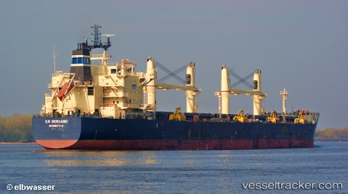
Vessel profile: PRINCESS MARIA is a Bulk Carrier with dimensions 187m x 32m.
This page combines live AIS, route history, probable destination signals, nearby traffic, and port activity for practical vessel monitoring.
The current position of vessel PRINCESS MARIA is 9.38167 lat / 125.95167 lng. Updated: 2026-03-29 03:04:18 UTCNearest reference points:
- Near Taganito
- Near Hilongos
- 16 nm E of Danao
Currently sailing under the flag of Marshall Islands ![]()
PRINCESS MARIA built in 2009 year
Deadweight:
55783 tDetails:
Live Vessel PRINCESS MARIA Analytics (details, animations, etc.)
Recent AIS points (UTC):
2026-03-29 01:28:20 UTC · 9.38333, 125.95167 · SOG 0 kn · COG -1°2026-03-29 03:04:18 UTC · 9.38167, 125.95167 · SOG 0 kn · COG -1°
2026-03-29 03:04:18 UTC · 9.38167, 125.95167 · SOG 0 kn · COG -1°
2026-03-29 03:04:18 UTC · 9.38167, 125.95167 · SOG 0 kn · COG -1°