 vesseltracker.com
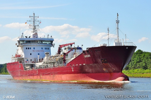
 KATELINA
Current Status
Where is the vessel?
KATELINA is currently in Near Domburg, based on AIS data received about 2h ago.
Latest AIS update:
Current position: 51.61271° N, 3.37365° E (Near Domburg)
Average speed (last 7 days): Loading…
Average speed (last 30 days): Loading…
Vessel profile: KATELINA is a Tanker with dimensions m x m.
This page combines live AIS, route history, probable destination signals, nearby traffic, and port activity for practical vessel monitoring.
The current position of vessel KATELINA is 51.61271 lat / 3.37365 lng. Updated: 2026-03-26 17:31:33 UTCNearest reference points:
- Near Hunsdon
- Near BRESKENS
- Near Flushing
Currently sailing under the flag of Portugal ![]()
Details:
Live Vessel KATELINA Analytics (details, animations, etc.)
Recent AIS points (UTC):
2026-03-26 12:22:41 UTC · 51.34613, 4.28420 · SOG 0 kn · COG 273°2026-03-26 13:54:26 UTC · 51.37059, 4.10197 · SOG 12.2 kn · COG 268°
2026-03-26 15:46:22 UTC · 51.41177, 3.71027 · SOG 11.9 kn · COG 342°
2026-03-26 17:31:33 UTC · 51.61271, 3.37365 · SOG 12.1 kn · COG 326°