 vesseltracker.com
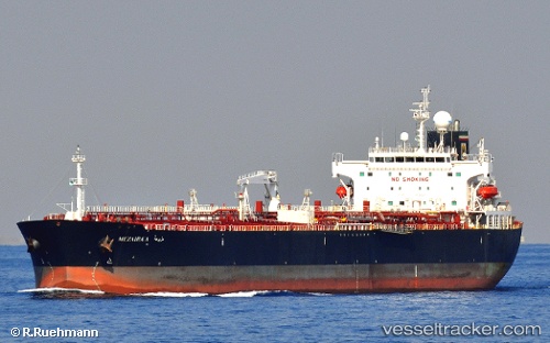
 Mezairaa
Current Status
Where is the vessel?
Mezairaa is currently in 13 nm W of PORT DICKSON, based on AIS data received about 5h ago.
Latest AIS update:
Current position: 2.44860° N, 101.58437° E (13 nm W of PORT DICKSON)
Average speed (last 7 days): Loading…
Average speed (last 30 days): Loading…
Vessel profile: Mezairaa is a Crude Oil Tanker with dimensions 228m x 32m.
This page combines live AIS, route history, probable destination signals, nearby traffic, and port activity for practical vessel monitoring.
The current position of vessel Mezairaa is 2.44860 lat / 101.58437 lng. Updated: 2026-04-10 08:09:02 UTCNearest reference points:
- 13 nm SW of PORT DICKSON
- Near PORT DICKSON
- 14 nm SW of Banting
Currently sailing under the flag of Liberia ![]()
Mezairaa built in 2011 year
Deadweight:
74854 tDetails:
Live Vessel Mezairaa Analytics (details, animations, etc.)
Recent AIS points (UTC):
2026-04-10 01:36:06 UTC · 3.19328, 100.52122 · SOG 5.8 kn · COG -1°2026-04-10 04:09:15 UTC · 2.88208, 100.90738 · SOG 12.1 kn · COG -1°
2026-04-10 05:57:03 UTC · 2.68146, 101.21262 · SOG 11.9 kn · COG 117°
2026-04-10 08:09:02 UTC · 2.44860, 101.58437 · SOG 12.2 kn · COG 127°