 vesseltracker.com
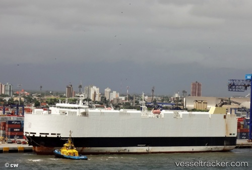
 VIKING PASSAMA
Current Status
Where is the vessel?
VIKING PASSAMA is currently in 186 nm S of Eauripik Atoll, based on AIS data received less than 1h ago.
Latest AIS update:
Current position: 3.64346° N, 142.54153° E (186 nm S of Eauripik Atoll)
Average speed (last 7 days): Loading…
Average speed (last 30 days): Loading…
Vessel profile: VIKING PASSAMA is a Vehicles Carrier with dimensions 30m x 182m.
This page combines live AIS, route history, probable destination signals, nearby traffic, and port activity for practical vessel monitoring.
The current position of vessel VIKING PASSAMA is 3.64346 lat / 142.54153 lng. Updated: 2026-04-09 19:43:19 UTCCurrently sailing under the flag of Marshall Islands ![]()
VIKING PASSAMA built in 2012 year
Deadweight:
12806 tDetails:
Live Vessel VIKING PASSAMA Analytics (details, animations, etc.)
Recent AIS points (UTC):
2026-04-09 13:59:28 UTC · 2.21901, 143.33524 · SOG 16.8 kn · COG 331°2026-04-09 15:55:28 UTC · 2.69749, 143.06860 · SOG 16.9 kn · COG 332°
2026-04-09 17:35:52 UTC · 3.11425, 142.83649 · SOG 17.1 kn · COG 330°
2026-04-09 19:43:19 UTC · 3.64346, 142.54153 · SOG 16.8 kn · COG 329°