 vesseltracker.com
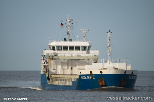
 Blue Note
Current Status
Where is the vessel?
Blue Note is currently in 15 nm E of Cabo de Palos, based on AIS data received less than 1h ago.
Latest AIS update:
Current position: 37.70535° N, 0.39143° W (15 nm E of Cabo de Palos)
Average speed (last 7 days): Loading…
Average speed (last 30 days): Loading…
Vessel profile: Blue Note is a Multi Purpose Carrier with dimensions 89m x 16m.
This page combines live AIS, route history, probable destination signals, nearby traffic, and port activity for practical vessel monitoring.
The current position of vessel Blue Note is 37.70535 lat / -0.39143 lng. Updated: 2026-04-21 05:52:00 UTCNearest reference points:
- Near Torre Horadada
- Near Playa San Agustin
- Near TORREVIEJA
Currently sailing under the flag of Antigua Barbuda ![]()
Blue Note built in 2010 year
Deadweight:
5203 tDetails:
Live Vessel Blue Note Analytics (details, animations, etc.)
Recent AIS points (UTC):
2026-04-21 01:45:39 UTC · 37.26843, -0.92041 · SOG 8.9 kn · COG 45°2026-04-21 04:06:20 UTC · 37.50232, -0.59547 · SOG 9 kn · COG 52°
2026-04-21 04:28:00 UTC · 37.53491, -0.54164 · SOG 8.9 kn · COG 52°
2026-04-21 05:52:00 UTC · 37.70535, -0.39143 · SOG 9.1 kn · COG 37°