 vesseltracker.com
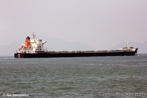
 JIA NING
Current Status
Where is the vessel?
JIA NING is currently in Near Pok Fu Lam, based on AIS data received about 1h ago.
Latest AIS update:
Current position: 22.17211° N, 114.11452° E (Near Pok Fu Lam)
Average speed (last 7 days): Loading…
Average speed (last 30 days): Loading…
Vessel profile: JIA NING is a Bulk Carrier with dimensions m x m.
This page combines live AIS, route history, probable destination signals, nearby traffic, and port activity for practical vessel monitoring.
The current position of vessel JIA NING is 22.17211 lat / 114.11452 lng. Updated: 2026-04-05 19:56:13 UTCNearest reference points:
- Near Pok Fu Lam
- Near WAILINGDING ISLAND
- Near Tai Tam
Currently sailing under the flag of China ![]()
Details:
Live Vessel JIA NING Analytics (details, animations, etc.)
Recent AIS points (UTC):
2026-04-05 14:23:17 UTC · 22.17231, 114.11176 · SOG 0.2 kn · COG 140°2026-04-05 16:06:11 UTC · 22.17329, 114.11144 · SOG 0 kn · COG 137°
2026-04-05 17:27:15 UTC · 22.17354, 114.11185 · SOG 0 kn · COG 152°
2026-04-05 19:56:13 UTC · 22.17211, 114.11452 · SOG 0.1 kn · COG 259°