 vesseltracker.com
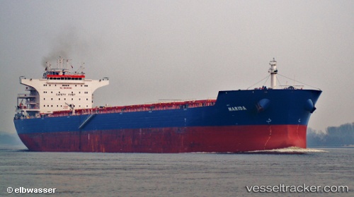
Flag Tom
Current StatusWhere is the vessel?
Flag Tom is currently in 11 nm E of PORT DOUGLAS, based on AIS data received about 3h ago.
Latest AIS update:
Current position: 16.46038° S, 145.64905° E (11 nm E of PORT DOUGLAS)
Average speed (last 7 days): Loading…
Average speed (last 30 days): Loading…
Vessel profile: Flag Tom is a Bulk Carrier with dimensions 38m x 229m.
This page combines live AIS, route history, probable destination signals, nearby traffic, and port activity for practical vessel monitoring.
The current position of vessel Flag Tom is -16.46038 lat / 145.64905 lng. Updated: 2026-03-26 07:41:51 UTCNearest reference points:
- Near CAIRNS
Details:
Live Vessel Flag Tom Analytics (details, animations, etc.)
Recent AIS points (UTC):
2026-03-26 01:41:12 UTC · -17.40050, 146.18288 · SOG 12.3 kn · COG 348°2026-03-26 03:49:43 UTC · -16.97358, 146.05505 · SOG 12.4 kn · COG 341°
2026-03-26 05:42:53 UTC · -16.75705, 145.85298 · SOG 6.7 kn · COG 316°
2026-03-26 07:41:51 UTC · -16.46038, 145.64905 · SOG 12.2 kn · COG 344°