 vesseltracker.com
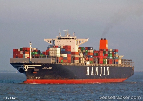
 MAERSK ENSENADA
Current Status
Where is the vessel?
MAERSK ENSENADA is currently in 324 nm S of Abakaliki, based on AIS data received about 1h ago.
Latest AIS update:
Current position: 1.30358° N, 87.96575° E (324 nm S of Abakaliki)
Average speed (last 7 days): Loading…
Average speed (last 30 days): Loading…
Vessel profile: MAERSK ENSENADA is a Container Ship with dimensions m x m.
This page combines live AIS, route history, probable destination signals, nearby traffic, and port activity for practical vessel monitoring.
The current position of vessel MAERSK ENSENADA is 1.30358 lat / 87.96575 lng. Updated: 2026-04-22 05:42:24 UTCNearest reference points:
- Open sea, approx. 400 nm off the nearest listed port
- Open sea, approx. 402 nm off the nearest listed port
- Open sea, approx. 403 nm off the nearest listed port
Currently sailing under the flag of Singapore ![]()
Details:
Live Vessel MAERSK ENSENADA Analytics (details, animations, etc.)
Recent AIS points (UTC):
2026-04-22 04:49:55 UTC · 1.44694, 88.18094 · SOG 17.9 kn · COG 238°2026-04-22 04:49:55 UTC · 1.44694, 88.18094 · SOG 17.9 kn · COG 238°
2026-04-22 05:42:24 UTC · 1.30358, 87.96575 · SOG 17.9 kn · COG 235°
2026-04-22 05:42:24 UTC · 1.30358, 87.96575 · SOG 17.9 kn · COG 235°