 vesseltracker.com
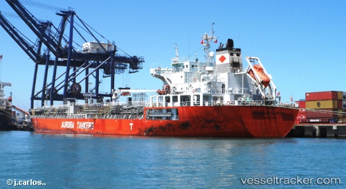
 AAPUS 11
Current Status
Where is the vessel?
AAPUS 11 is currently in Near Palm Beach, based on AIS data received about 1h ago.
Latest AIS update:
Current position: 26.73668° N, 80.02598° W (Near Palm Beach)
Average speed (last 7 days): Loading…
Average speed (last 30 days): Loading…
Vessel profile: AAPUS 11 is a Oil/Chemical Tanker with dimensions m x m.
This page combines live AIS, route history, probable destination signals, nearby traffic, and port activity for practical vessel monitoring.
The current position of vessel AAPUS 11 is 26.73668 lat / -80.02598 lng. Updated: 2026-03-31 11:36:02 UTCNearest reference points:
- Near Rivera Beach
- Near Palm Beach
- Near Lake Park
Currently sailing under the flag of Panama ![]()
Details:
Live Vessel AAPUS 11 Analytics (details, animations, etc.)
Recent AIS points (UTC):
2026-03-31 05:24:03 UTC · 26.73670, -80.02585 · SOG 0 kn · COG 115°2026-03-31 08:18:05 UTC · 26.73673, -80.02595 · SOG 0 kn · COG 108°
2026-03-31 10:24:04 UTC · 26.73668, -80.02593 · SOG 0.1 kn · COG 110°
2026-03-31 11:36:02 UTC · 26.73668, -80.02598 · SOG 0.1 kn · COG 113°