 vesseltracker.com
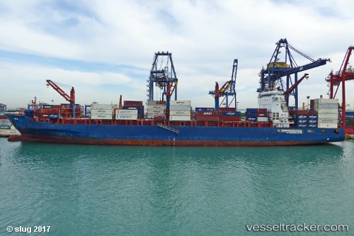
 Ete N
Ete N
Current Status
Where is the vessel?
Ete N is currently in Near NEMRUT, based on AIS data received less than 1h ago.
Latest AIS update:
Current position: 38.76195° N, 26.92669° E (Near NEMRUT)
Average speed (last 7 days): Loading…
Average speed (last 30 days): Loading…
Vessel profile: Ete N is a Container Ship with dimensions 212m x 33m.
This page combines live AIS, route history, probable destination signals, nearby traffic, and port activity for practical vessel monitoring.
The current position of vessel Ete N is 38.76195 lat / 26.92669 lng. Updated: 2026-04-09 01:58:25 UTCNearest reference points:
- Near NEMRUT
- Near Nemrut Bay
- Near Aliaga
Currently sailing under the flag of Liberia ![]()
Ete N built in 2012 year
Deadweight:
41139 tDetails:
Live Vessel Ete N Analytics (details, animations, etc.)
Recent AIS points (UTC):
2026-04-08 17:46:25 UTC · 38.76198, 26.92666 · SOG 0.1 kn · COG 176°2026-04-08 20:10:26 UTC · 38.76196, 26.92669 · SOG 0 kn · COG 176°
2026-04-08 23:22:25 UTC · 38.76195, 26.92666 · SOG 0 kn · COG 176°
2026-04-09 01:58:25 UTC · 38.76195, 26.92669 · SOG 0 kn · COG 176°