 vesseltracker.com
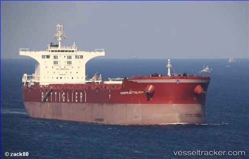
 CAPE SEAGULL
Current Status
Where is the vessel?
CAPE SEAGULL is currently in 26 nm SW of Kukdo, based on AIS data received less than 1h ago.
Latest AIS update:
Current position: 34.14922° N, 128.18597° E (26 nm SW of Kukdo)
Average speed (last 7 days): Loading…
Average speed (last 30 days): Loading…
Vessel profile: CAPE SEAGULL is a Bulk Carrier with dimensions 295m x 295m.
This page combines live AIS, route history, probable destination signals, nearby traffic, and port activity for practical vessel monitoring.
The current position of vessel CAPE SEAGULL is 34.14922 lat / 128.18597 lng. Updated: 2026-04-01 14:18:07 UTCNearest reference points:
- 25 nm S of Kukdo
- 35 nm E of Geomundo
- 15 nm S of Kukdo
Currently sailing under the flag of United Kingdom ![]()
CAPE SEAGULL built in 2011 year
Deadweight:
175243 tDetails:
Live Vessel CAPE SEAGULL Analytics (details, animations, etc.)
Recent AIS points (UTC):
2026-04-01 07:49:29 UTC · 34.14500, 128.18500 · SOG 0 kn · COG -1°2026-04-01 10:12:43 UTC · 34.14800, 128.18117 · SOG 0 kn · COG -1°
2026-04-01 11:42:53 UTC · 34.14899, 128.18279 · SOG 0.1 kn · COG -1°
2026-04-01 14:18:07 UTC · 34.14922, 128.18597 · SOG 0 kn · COG -1°