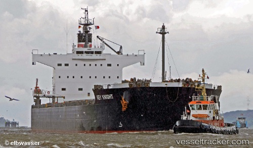
.
Vessel photo of KEY KNIGHT (IMO 9512317) vesseltracker.com

LB flag KEY KNIGHT

Vessel type: Bulk Carrier | IMO: 9512317 | MMSI: MMSI: 636020651
Call sign: 5LAA8 | Dimensions: 32 m x 229 m
Current Status

Where is the vessel?

KEY KNIGHT is currently in 377 nm NW of Fukagawa, based on AIS data received about 1h ago.

Latest AIS update:

Current position: 38.33832° N, 146.93919° W (377 nm NW of Fukagawa)

Average speed (last 7 days): Loading…

Average speed (last 30 days): Loading…

Vessel profile: KEY KNIGHT is a Bulk Carrier with dimensions 32m x 229m.

This page combines live AIS, route history, probable destination signals, nearby traffic, and port activity for practical vessel monitoring.

The current position of vessel KEY KNIGHT is 38.33832 lat / -146.93919 lng. Updated: 2026-03-31 01:29:01 UTC
Nearest reference points:
  • Open sea, approx. 409 nm off the nearest listed port
  • Open sea, approx. 416 nm off the nearest listed port
  • Open sea, approx. 426 nm off the nearest listed port

Currently sailing under the flag of Liberia LB flag

KEY KNIGHT built in 2012 year

Deadweight:
82099 t

Details:

Live Vessel KEY KNIGHT Analytics (details, animations, etc.)


Recent AIS points (UTC):
2026-03-30 19:27:28 UTC · 38.56979, -147.97012 · SOG 7.6 kn · COG 102°
2026-03-30 21:41:32 UTC · 38.49552, -147.61009 · SOG 8.4 kn · COG 102°
2026-03-30 23:59:39 UTC · 38.40346, -147.22697 · SOG 7.6 kn · COG 106°
2026-03-31 01:29:01 UTC · 38.33832, -146.93919 · SOG 11.7 kn · COG 102°

Track of the vessel in the last 28 days


UTC: --
Start: -- Track timeline (UTC) End: --
Encountered: --


Link to the map:


Find another ship

KEY_KNIGHT (636020651) last ports (portcalls and passsages)

PANAMA CITY | 2025-09-08 16:23:34
Taboguilla | 2025-09-08 11:19:32
Honshu | 2025-08-04 23:36:54
TACHIBANA | 2025-08-01 01:11:56
Newcastle | 2025-07-15 16:22:01
TAKAHAMA | 2025-06-22 05:52:51
Imabari | 2025-06-22 03:59:50
MARUGAME | 2025-06-22 00:41:48
MIZUSHIMA | 2025-06-18 07:35:45
Shimotsui | 2025-06-18 07:24:53
AJICHO | 2025-06-18 05:40:57
AKASHI | 2025-06-18 01:58:12
KADA | 2025-06-17 18:05:54
MEKAR PUTIH | 2025-06-05 00:50:17
MEKAR PUTIH | 2025-06-01 00:16:06
MEKAR PUTIH | 2025-05-27 23:07:06
Taboneo | 2025-03-22 03:16:35
Taboneo | 2025-03-18 03:04:12
Taboneo | 2025-02-24 23:43:36
Taboneo | 2025-02-20 23:20:31
Taboneo | 2025-01-31 03:24:58
Taboneo | 2025-01-27 02:45:12
SUMOTO | 2024-12-24 04:14:49
TAKASAGO | 2024-12-20 06:00:18
HIGASHIHARIMA | 2024-12-20 05:58:35
AKASHI | 2024-12-20 03:56:25
Yen-Tai | 2024-11-29 10:10:25
TANAH MERAH | 2024-11-16 02:26:01
BATU AMPAR | 2024-11-16 00:58:44
PULAU SAMBU | 2024-11-16 00:28:45
Tuticorin | 2024-10-17 17:31:13
Paradip | 2024-10-10 15:11:30
Paradip | 2024-10-06 14:32:25
Sambu | 2024-10-01 04:51:40
Matsuga-hana | 2024-09-20 03:34:00
Shimotsui | 2024-09-18 09:48:44
Matsuga-hana | 2024-09-14 21:58:13
Shimotsui | 2024-09-14 08:31:10
Gladstone Harbor | 2024-07-23 20:21:27
Tokuyama | 2024-07-05 05:12:45
Tokuyama | 2024-07-01 04:22:36
Newcastle | 2024-06-14 02:01:51
Yokohama | 2024-05-17 21:24:17
Kawasaki | 2024-05-17 13:28:48
Yokosuka | 2024-05-17 12:25:59
Singapore | 2024-03-23 14:40:07
Gopalpur | 2024-03-12 14:45:51
Haldia | 2024-03-09 07:11:37
Vishakhapatnam | 2024-03-04 07:23:21
Singapore | 2024-02-27 07:42:07
Gladstone Harbor | 2024-02-09 18:52:07
Shimotsui | 2024-01-11 08:33:32
Ra’S Shukhayr | 2023-11-26 15:59:34
Ras Gharib | 2023-11-26 13:40:50
Bur Ibrahim | 2023-11-26 02:46:08
Port Said | 2023-11-25 07:48:24
Baltimore | 2023-10-28 19:25:12
Annapolis | 2023-10-27 08:37:33
Strait Of Gibraltar | 2023-09-30 03:07:00
Port Said | 2023-09-22 17:45:14
Bur Ibrahim | 2023-09-22 07:54:24
Ra’S Shukhayr | 2023-09-21 02:00:43
Port Kembla | 2023-08-16 21:00:03
Tatibana Ko | 2023-07-21 23:59:32
Anan | 2023-07-21 23:24:04
Newcastle | 2023-07-03 12:29:14
Victoria | 2023-05-14 07:22:48
Tsugaru-Kaikyo | 2023-04-28 04:21:59
Tatibana Ko | 2023-03-30 07:58:04
Prince Rupert | 2023-02-20 17:06:47